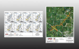
The Iowa Department of Transportation in coordination with the Federal Highway Administration recently conducted an in-depth assessment of a portion of land north-northwest of Oskaloosa. The plan: building a bypass that converges north and south traffic on Highway 63 to Highway 163.
The idea of building such bypass has been on the thoughts of many for years now. The study began in July of 2013, recently the Environmental Assessment was released.
There is hard-hitting evidence that this could greatly improve traffic, accident rates and safety in and around Oskaloosa. The crash rate on Highway 63 above the statewide average, by almost 20-percent. From 2007-2011, the rural crash rates on Highway 63 were also higher that statewide averages.
Between 2010 and 2014 there were 171 crashes on Highway 63 within the Oskaloosa corporate limits, a stretch of road that is only 3.1 miles.
The Enivronmental Assessment addresses the need to improve traffic operations stating that “currently, all through traffic on U.S. 63 in the study area must travel through the city of Oskaloosa through its busiest intersection at U.S. 63 and IA 92 located along the west side of the City Square Park in downtown.” Many semi, freight and grain truck traffic operates on these routes coming from Eddyville, Bussey or Ottumwa area to travel north to New Sharon, Pella or traffic determined for Interstate 80.
By creating this bypass, semi and constant highway traffic will be kept out of the city of Oskaloosa. Freeing up one of the busiest intersections from turning or merging freight truck traffic in the city. The proposed bypass would begin on the intersection of Highway 163 and 235th Street, it would then meet Highway 63 roughly at 210th Street (East).

Within this assessment the DOT took research notes about the intended area and landscape. Making sure to log the various areas that were considered wetlands, woodlands, flood lands, prime farming land, the location of streams or rivers, and what the department determined as bad habitat. Listings of plant species located within the study area is also readily available.
A question some may have with this proposed bypass would be the widely talked about Regional Airport location. The assessment covered that as well. An Environmental Assessment was completed for the proposed airport for the Federal Aviation Administration in October 2016. The location of the proposed airport would lie just west of the proposed interchange of the U.S. 63 Oskaloosa Bypass and IA 163.
The Iowa DOT is soliciting comments on the document during the comment period which ends December 4, 2017. To be considered in the decision document, please email or postmark your comments by that date and send them to:
Tamara Nicholson
Iowa DOT – Office of Location and Environment
Information derived from the Environmental Assessment from the Iowa DOT.
The full document is available online: Oskaloosa Environmental Assessment


