DES MOINES — After significant localized heavy rainfall and flooding in June, July continued the trend with above-average rainfall, according to the latest Water Summary Update.
July’s preliminary statewide precipitation was 5.40 inches, or 1.23 inches above normal. However, precipitation totals varied greatly across different regions of the state.
In central Iowa, Pella received nearly 14 inches of rain in July, while Rock Rapids in northwest Iowa received less than one inch for the month. The state has received more than 30 inches of rain in the last 10 months, nearly four inches greater than normal. July also showed an average statewide temperature of 72.4 degrees, one degree below normal.
“July is normally a fairly wet month in Iowa, so to finish above normal means we have continued to get needed moisture to replenish what was missed during the last four years of drought,” said Tim Hall, the DNR’s Hydrology Resources Coordinator. “If we continue to see normal to above normal rainfall for the rest of the summer and then into the fall months, our hydrologic resources should be in great shape this year.”
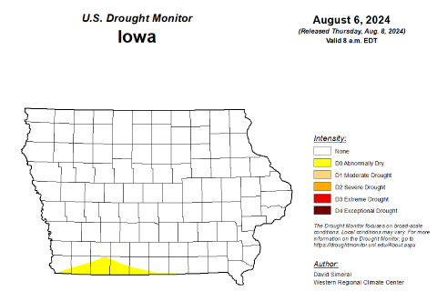
Although the U.S. Drought Monitor (USDM) showed no drought or dryness anywhere in the state as of July 16, a small region of southwest Iowa received an abnormal dryness designation due to short-term rainfall deficits in northwest Missouri and southwest Iowa. Despite this development, Iowa’s Drought Plan showed all five monitoring regions are drought free, with stabilized conditions at the end of July.
For a thorough review of Iowa’s water resource trends, visit


