By Dar Danielson (Radio Iowa)
State Climatologist Justin Glisan says this fall is going down among the warmest we’ve ever seen in Iowa.
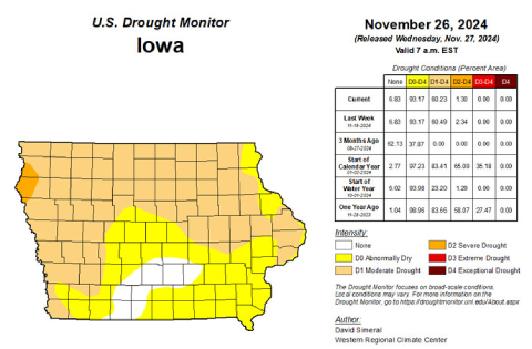
“Over four degrees above average for meteorological fall, September, October, November, so with 152 years of records looking like in the top 10 warmest falls on record,” Glisan says. The fall was on course to be one of the driest on record through the first two months. “The driest September, on record, 51st driest October, and then we get into a wet November. So kind of a balancing act there, but overall, we were drier than average, and that’s where we did see some drought conditions reemerge across the state. Recently we’ve had improvements with a wetter November,” he says.
He says rains late in November kept it from a dry overall outcome. “Not too much snow. We had a few flakes flying through the month, some rainfall, though we were about three inches, three and a quarter inches across the state, and that’s almost an inch-and-a-half above average,” Glisan says. Glisan says November was wet enough to push it up the record chart. “Overall for November, this looks like it will be in the top 20 wettest November is on record,” he says. November also saw temperatures about three degrees above average.


